Chesapeake Bay Fishing
Fishing in the Chesapeake Bay and Tributaries
Quick Links: Fishing Reports | Fishing Regulations | Fishing Charters
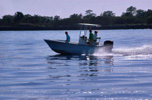
The Chesapeake Bay offers a wealth of sport fishing opportunities.
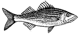
Favorite Chesapeake Bay species include rockfish, bluefish, drum, speckled trout, flounder, spot, and croaker.
Look below for regulations, reports, and resources for fishing Maryland and Virginia’s Chesapeake Bay waters. We also have a large list of Chesapeake Bay charter boat operators.
If you’re looking for some great Chesapeake Bay fishing advice, Rudow’s Guide to Fishing the Chesapeake is a good resource. Field Guide to Fishes of the Chesapeake Bay is also a good reference to have.
The Chesapeake Bay Program’s Bay Field Guide has good information on the types of fish that live in the Bay. They have pictures and information on where each type of fish lives and what it eats. And it covers everything, not just the game fish. So if you ever wondered what’s in the water, this is a good reference.
We provide links to lots of good fishing-related information further down on this page. You’ll find info on fishing reports, charter fishing boats, fishing regulations, weather & tides, waypoints, and more.
Chesapeake Bay Fishing Reports
Chesapeake Bay Fishing Reports – Fishing reports from around the region.
Know the Regulations
Make sure you’re legal. Fishing regulations are different for Maryland and Virginia waters.
Learn about Chesapeake Bay fishing regulations and licensing requirements.
Chesapeake Bay Fishing Charters
View our Charter Boat Listings – Find charter boats available throughout the Chesapeake Bay region.
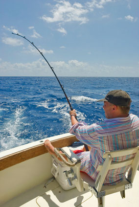
There are Chesapeake Bay Charter fishing boats operating throughout the Maryland and Virginia regions of the Bay. If you want to be assured of a good day of Chesapeake Bay fishing, taking a charter is a great option. Most Chesapeake Bay towns have at least a few fishing charters operating out of their port. Some of the larger charter fleets are located in Deale, Chesapeake Beach, Solomons, Kent Island, and Reedville are popular places for charter fishing boats to depart from.
Charter captains know where the fish are and how to catch them. They will provide the fishing tackle and bait and they’ll ice down your catch for you. BayDreaming.com’s Chesapeake Bay Charter Fishing Directory will point you to the websites for fishing charter captains in the Chesapeake Bay area.
Recommended Chesapeake Bay Fishing Books
Rudow’s Guide to Fishing the Chesapeake
This very popular guide to fishing the Chesapeake Bay covers each region of the Bay, tells you what you’re likely to find there, and how best to catch it.

Rudow’s Guide to Fishing the Chesapeake takes three approaches to covering Chesapeake Bay fishing. First it provides regional guides for the Upper, Middle and Lower Chesapeake Bay. Next it covers tactics and tackle. And last there are sections for 20 different sport fish.
The book has lots of tips, detailed information and observations throughout.
Field Guide to Fishes of the Chesapeake Bay
This field guide, published in March of 2013, provides information about over 200 species of the fish that live in the Chesapeake.

Field Guide to Fishes of the Chesapeake Bay is a good reference for fishermen, but also very interesting for anyone who lives around and likes to explore the Bay.
Color illustrations are provided for each species as well as descriptions, habitat, food habits, and reproduction information.
Trolling for Striped Bass and Bluefish
This book will help you get the most out of Striped Bass season.

Trolling for Striped Bass and Bluefish tells you what you need to know about outfitting your boat for trolling, selecting the best lures and lines, and the most effective trolling speeds and patterns.
The Author, Pete Barrett, is an experienced charter boat operator who’s fishing articles have been featured in many national publications.
The Ultimate Guide to Striped Bass Fishing: Where to Find Them, How to Catch Them
Details on how to catch Striped Bass by surfcasting, bait fishing, trolling, and fly-fishing.

With the tips provided by the author and a better understanding of the rockfish’s biology, life cycle, and habits, you’ll be well-armed to go out and catch your limit.
The author, Eric B. Burnley Sr. has over 40 years of experience with striped bass fishing and is an accomplished writer and guide.
Waypoints
There are several websites available that list Chesapeake Bay Loran and GPS waypoints for fishing and boating use. We’ve gathered links to these sites and have provided them below.
Chesapeake Bay Fishing Hot Spots
Listing of user entered coordinates for favorite Chesapeake Bay fishing locations.
Daybreak Local Fishing Information
Collection of GPS and Loran waypoints for Maryland’s lower Eastern Shore and Virginia’s Eastern Shore.
Wrecks
Loran and GPS coordinates for Chesapeake Bay wrecks.
Virginia’s Artificial Reef Program
Description and coordinates for artificial reefs.
Weather and Tides
Check out our weather and tides page for marine forecasts, wind forecasts, tides information, water temperatures, and more.